
Every property and Starlink project is different. This guide explains the practical factors considered during professional installation and helps you prepare informed questions before work begins.
What the obstruction map is showing
After Starlink has operated long enough to observe its surroundings, the app builds a map of the dish's usable sky. The map is based on what the terminal actually sees over time, so it may remain incomplete immediately after startup, a reboot, or a change in dish location.
The map should be read as a history of sky visibility—not a photograph and not a live weather radar. Starlink continuously updates its understanding of nearby trees, rooflines, poles, buildings, and other objects.
What the white or light points mean
White or light-colored points generally represent portions of the sky the system has observed as clear or where it has successfully tracked communication opportunities. They help show the field of view Starlink is using as satellites move across the sky.
Some app versions also show light bands, blank areas, or an exclusion zone that should not be mistaken for a physical obstruction. Colors and display style can change with app updates, so the written obstruction estimate and outage history should be considered alongside the map.
What the red points mean
Red points indicate areas where the expected view was blocked or where the terminal identified an obstruction. A few isolated points may have little noticeable effect, while a dense red cluster in an active part of the field of view can cause repeated brief interruptions as satellites pass behind it.
The shape often helps identify the source. A moving, irregular edge may follow tree branches, while a straight band may correspond to a roof, wall, chimney, or another structure. Starlink recommends a fully unobstructed view for best performance because even small obstructions can reduce connection quality.
Need help with this on your Starlink system?
Mann's Starlink Contracting provides owner-installed service throughout Kentucky and an 11-state region.
Alignment and obstructions are separate
Alignment describes whether a manually positioned Standard dish is aimed in the direction and angle requested by the Starlink app. Obstructions describe whether objects block the sky within the dish's working field of view. A dish can be accurately aligned and still sit beneath a tree, or have open sky while being aimed away from the recommended heading.
The app's Alignment tool should be used after the system comes online. The correct direction depends on the location and current network assignment. In much of the continental United States the recommended view is often toward the northern sky, but true north is not a universal instruction for every address.
Can Starlink work when it is not perfectly aligned?
The phased-array antenna can electronically steer its beam and may establish or maintain a connection even when the dish is not perfectly aimed. That is why a misaligned dish can sometimes appear to function while pointing noticeably away from the app's target.
This does not mean every direction is equally suitable. Greater misalignment reduces the usable field of view and can increase interruptions or limit the satellites the system can follow. The app's recommended alignment—not a general compass rule—should be treated as the target for dependable operation.
Alignment does not guarantee top speed
A perfectly aligned, unobstructed dish can still produce different speed-test results throughout the day. Network congestion, service plan priority, weather, Wi-Fi interference, router placement, device capability, server selection, and background traffic can all affect measured speed.
Alignment is mainly about giving the terminal the best opportunity to maintain reliable satellite contact. It removes one potential limitation, but it cannot control every part of the path between a customer's device and the internet.
When relocation is the better fix
If the map repeatedly develops the same red obstruction cluster and the app reports interruptions, a small rotation may not solve the problem. The dish may need more height or a different mounting location with a broader clear view.
Before moving it, review safe access, structural mounting, cable length, future tree growth, roof maintenance, and the new cable route. Reset the obstruction history after a completed relocation only when appropriate, then allow enough operating time for the app to build a fresh map.
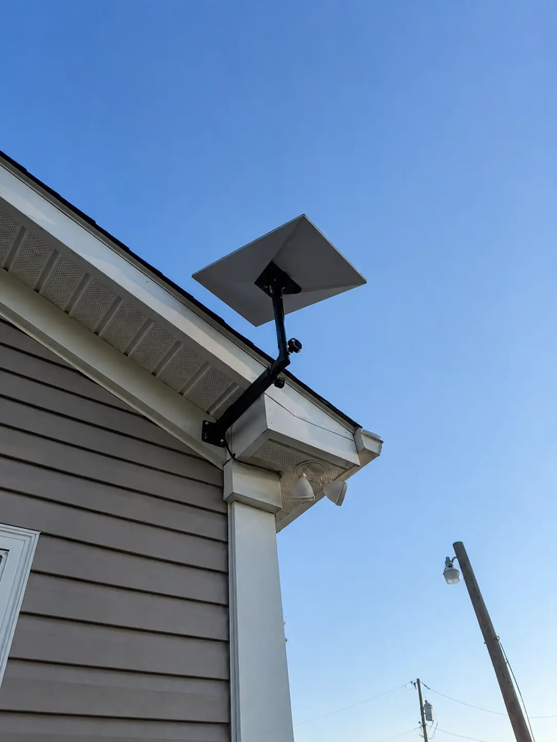
The bracket places the dish above the roof edge while the cable follows the outside of the house. Check the attachment and sky view for the actual property.
Installation and photo: Mann's Starlink Contracting · View full photo ↗Get a personal installation estimate.
Send your location and project details. Caleb will discuss your equipment and mounting needs, then confirm your complete quote before scheduling.
Questions first? Call Caleb directly at 270-940-4866.
Written byCaleb MannOwner and installer at Mann's Starlink Contracting. Caleb works directly with customers from project planning through final system setup.


